C-MAP REVEAL™ X - U.S. Lakes North Central
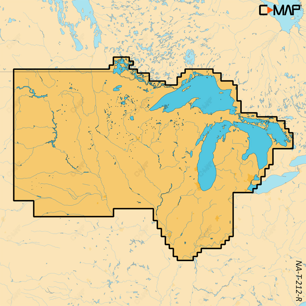
REVEAL™ X - U.S. Lakes North Central
COMPATIBILITY WITH SIMRAD NSX SERIES ONLY
Experience the X Generation of C-MAP charts - with game-changing Shaded Relief!
C-MAP® REVEAL™ X offers a fresh, dynamic experience. All the great features from DISCOVER X, including Map Inspector Tool, and more – bring the world around you to life with Shaded Relief and feel connected to your surroundings with Satellite Overlay. REVEAL X charts also deliver smooth integration with the Simrad® Companion App and come with 12 months of free online updates.
Next Generation Charts
- A fresh, dynamic chart experience, making navigation clearer than ever before
- Optimized data and new chart presentation to give you the best on-the-water navigation experience
- Always see the data you need without the clutter, optimized at every zoom level
- Best-in-class Day & Night modes. Stay safe and navigate with ease, whatever the weather, whatever the time of day
Smooth App Integration
- Link to the Simrad® Companion App – enjoy the same charts and a fully connected experience
- Plan trips, review tracks, and plot waypoints on the App, then sync straight to your NSX
- Access NSX manuals, “How To” guides, and much more, directly from the App
- The future is connected; with C-MAP & Simrad, you’ll be ready
Map Inspector Tool
- Quickly access the information you need, with a simple touch of the screen
- Tides & Currents – detailed projections of water level and tidal data to help you plan your day out
- Detailed Marina Port Plans – docking in an unfamiliar port is no problem when you have precise layouts of thousands of marinas, including slip spaces, restricted areas, and other vital information
Features:
- Smooth App Integration
- Map Inspector Tool
- Full-Featured Vector Charts
- High-Resolution Bathymetry
- Custom Depth Shading
- Best-in-Class Day & Night Modes
- Tides & Currents
- Detailed Marina & Port Plans
- Harbor & Approach Details
- Subscription-Free Autorouting
- 12 Months Free, Easy Chart Updates
- Connected Experience – Future-Proof
- Shaded Relief REVEAL Layer
- Satellite Imagery
Exclusively for REVEAL X
Shaded Relief
Bring the world around you to life with 3D rendered land and underwater elevation, including areas of ultra-high-resolution – a game-changer for anglers and divers
Satellite Imagery
Feel better connected to your surroundings when you find yourself in an unfamiliar place
This product may not be returned to the original point of purchase. Please contact the manufacturer directly with any issues or concerns.Free FTP System
FTP with CWR is easy, thorough, and detailed, no matter what kind of data you are transferring. Best of all, it’s free. No tedious data entry is needed when you're integrating your own business with our websites and databases
Top Selling C-MAP Products
Export Data Easily
CWR understands how important data export is to allowing your business to thrive. From order history to shipment data files to product files and beyond, we provide a variety of ways to view and analyze data on your end.
Become a CWR dealer and get:
- Wholesale pricing from over 300 brands
- No minimum order
- Flat rate shipping as low as $9.95
- Free FTP and website integration
BECOME A DEALER